Teaching
ZFL contributes to teaching geomatics at the Department of Geography of the University of Bonn. Besides the Remote Sensing Research Group (RSRG), it collaborates with the Center for Development Research (ZEF) of the University of Bonn and regularly offers applied GIS and Remote Sensing courses to its PhD students (e.g., a yearly introductory course to Remote Sensing and GIS).
Training and teaching are also part of different ZFL capacity building focused projects, which results in the conduction of virtual and in-person training sessions and development of training materials, often in collaboration with other partners, including international institutions like UN.
Winter Semester 2024/2025
Physische Geographie Aufbau
Umweltsysteme im Wandel und Wasser im Globalen Wandel - Applications with Earth Observation
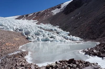
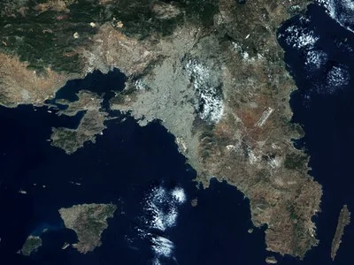
In Zeiten rasanter Umweltveränderungen und globaler Herausforderungen gewinnt die Fernerkundung zunehmend an Bedeutung und bietet innovative Möglichkeiten bestimmte Aspekte des globalen Wandels zu analysieren, zu verstehen und effektive Maßnahmen zu entwickeln. Das Seminar „Umweltsysteme im Wandel und Wasser im Globalen Wandel“ richtet sich an Studierende, die die aktuellen Methoden und Anwendungen der Fernerkundung kennenlernen und vertiefen möchten.
Seminar Bachelor Thesis
ZFL Colloquia
ZFL offers regular presentations by invited speakers about current remote sensing research.
Prof. Shunichi Koshimura (International Research Institute of Disaster Science, Tohoku University, Japan)
Enhancing Earth Observation and Modeling for Tsunami Disaster Response and Management
Prof. Ribana Roscher (Junior Professor for Remote Sensing at IGG, Dept. for Geodesy, Bonn University)
Pattern Recognition and Machine Learning for Remote Sensing
Dr. Corinne Frey (DLR)
Processing of AVHRR Data over Europe and North-Africa in the TIMELINE Project
Prof. Dr. Gilberto Camara (University of Münster)
Land Change In Brazilian Amazonia: A Case Study On Nature-Society Interaction
Pavel Propastin (Department of Cartography, GIS & Remote Sensing, Georg-August-University Göttingen)
Land degradation and rehabilitation in Kazakhstan: evaluations and controversies
Andrew Skidmore (ITC of the University of Twente, Wageningen University)
Hyper remote sensing: recent results with hyperspectral and hypertemporal imagery
Hermann Kaufmann (Remote Sensing Dept., GFZ, German Research Centre Potsdam)
Die Zukunft der optischen Fernerkundung - Abbildende Spektroskopie
Allan A. Nielsen (TU Denmark / Danish National Space Center)
Kernel Methods in Change Detection Based on Generalised Multivariate Difference Images
Tobias Hank (Dept. of Geography, Ludwig-Maximilians-Univ. Munich)
Akquise, Aufbereitung und Anwendungsmöglichkeiten hyperspektraler Fernerkundungsdaten am Beispiel der AVIS-Sensorenfamilie
Michael Schaepman (CGI/ESG, Wageningen Univ. and Research Center, Netherlands)
Quantitative Remote Sensing - Assessing the Plant (Non-)Pigmente System from Space
Natascha Oppelt (Dept. of Geography, Ludwig-Maximilians-Univ. Munich)
Hyperspektrale, multi-angulare Fernerkundung zur Ableitung von pflanzenphysiologischen Parametern
Andreas Brenner (FGAN, Wachtberg)
Hochauflösende Radarbildgebung urbaner Szenen mit dem flugzeuggetragenen X-Band-Sensor PAMIR
Henning Skriver (Technical University of Denmark, Danish National Space Center)
Polarimetric SAR Used for Land Cover Mapping and Change Detection
Dar Robert (University of California, Santa Barbara)
New Trends in Hyperspectral Remote Sensing in Natural and Anthropogenic Landscapes
Allan A. Nielsen (TU Denmark / Danish National Space Center)
The Regularized Iteratively Reweighted MAD Method for Change Detection in Multi- and Hyperspectral Data
Peter Verburg (Landscape Centre, Wageningen University, Netherlands)
Scenario-based Simulation of Land Use Change: Spatial Models as Discussion Support System
Uwe Rascher (Forschungszentrum Jülich)
Raum-zeitliche Musterbildung der Photosynthese vom Blatt zum Ökosystem. Wie können Fernerkundungsverfahren zum Verständnis von pflanzenvermittelten Austauschprozessen beitragen?
Benjamin Kötz (Remote Sensing Lab, Zurich, Switzerland)
Forest Parameter Estimation Based on 3-D Radiative Transfer Modeling
Michael Schmidt (CSIRO, Canberra, Australia)
Recent Advances in AVHRR Data Processing and Availability - an Australian Perspective
Stefan Hawlitschka (FGAN, Wachtberg)
Image interpretation in Radar Remote Sensing of Land Surfaces
Axel Thomas (Dept. of Geography, Univ. Mainz)
Erfahrungen und Konzepte einer GIS- und Fernerkundungs-gestützten agrarökonomischen Evaluierung der Provinz Yunnan, SW-China
Joachim Hill (Dept. of Geography, Univ. Trier)
Land Degradation and Desertification Processes in Mediterranean Regions
Rudi Goossens (Dept. of Geography, Univ. Gent, Belgium)
Historic Background, Current Status and Future Trends in 3D-Remote Sensing
Kurt P. Günther (DLR-DFD, Wessling)
MODIS, ein neuer Fernerkundungssensor für die Umweltbeobachtung